MuTeknologi Software
  • Home
  • About
  • Product
    • MoTuM
    • MuSed3D
    • MuDrillCutting3D
    • MuQual3D
    • MuHeat3D
    • MuTsunami
    • MuFlood
    • MuDO3D
  • Clients
  • Marine Facility Design
  • Blog
  • Lecture Notes

 Flood Early Warning System

Picture
Integration of River Flood Dynamics and Three Dimensional Ocean Hydrodynamics Model in GIS System

Model Description

Picture
River Flood Model Integrated to Ocean Hydrodynamics Model


​
​Suitable for Flood Early Warning System to predict Flood Height and Flood Arrival Time in Personal Computer
​

MuFlood consist of 4 modules:
  1. Unsteady River Flood Model
  2. Wet and Dry Model
  3. 3D Ocean Hydrodynamics Model
  4. GIS

Picture
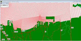
Rainfall Intensity Data can be obtained from Radar Image
Picture
Rainfall Intensity Prediction can be used as input

Results of Simulation

Picture
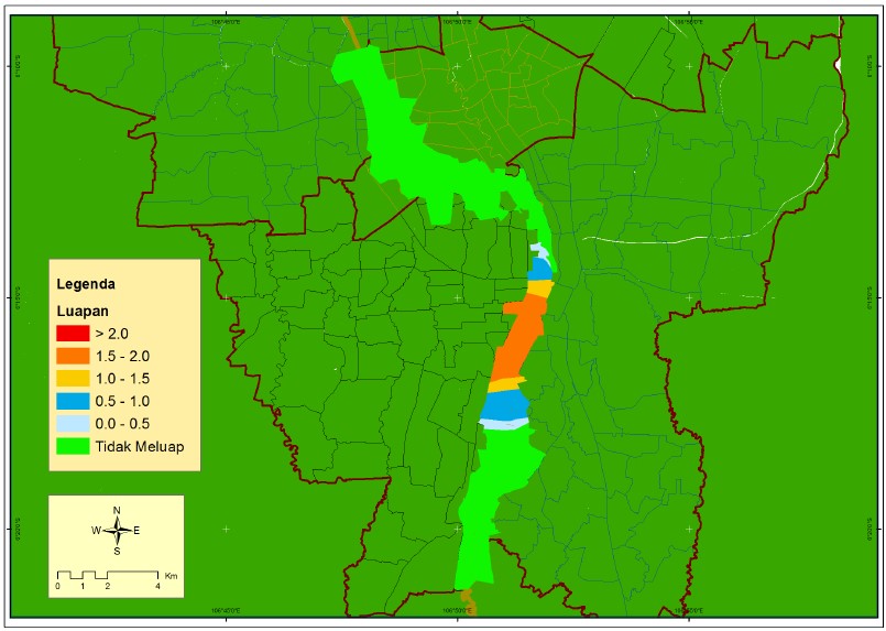
Flood Model Results for 11th October 2022
Picture
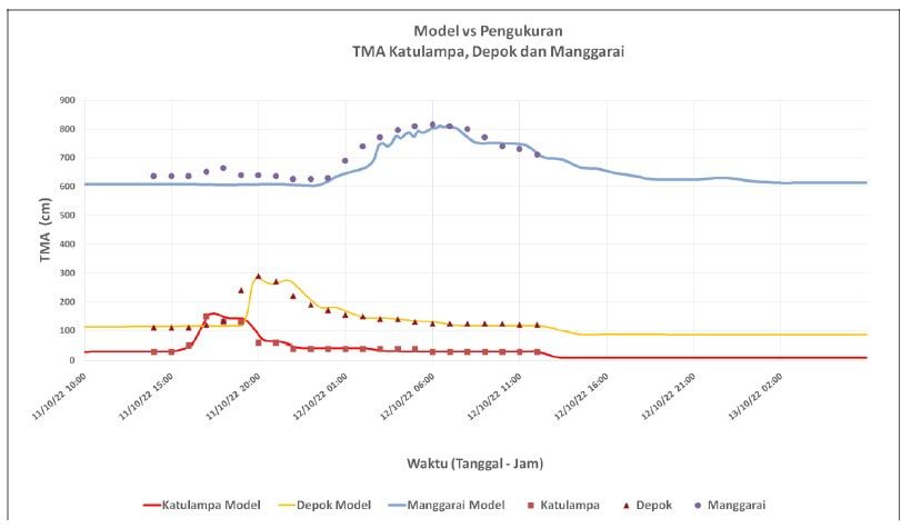
Comparison Model vs Observation Data for 11th October 2022
Picture
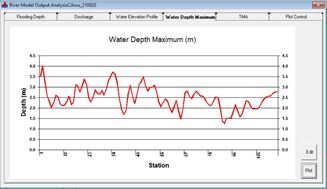
Simulation Results of Water Depth Maximum
Powered by Create your own unique website with customizable templates.
  • Home
  • About
  • Product
    • MoTuM
    • MuSed3D
    • MuDrillCutting3D
    • MuQual3D
    • MuHeat3D
    • MuTsunami
    • MuFlood
    • MuDO3D
  • Clients
  • Marine Facility Design
  • Blog
  • Lecture Notes