Home
About
Product
MoTuM
MuSed3D
MuDrillCutting3D
MuHeat3D
MuQual3D
MuTsunami
MuFlood
MuDO3D
Clients
Marine Facility Design
MuTeknologi News
Blog
Lecture Notes
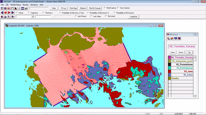
Embedded GIS
Display Environmental Sensitivity Index Mapping etc.
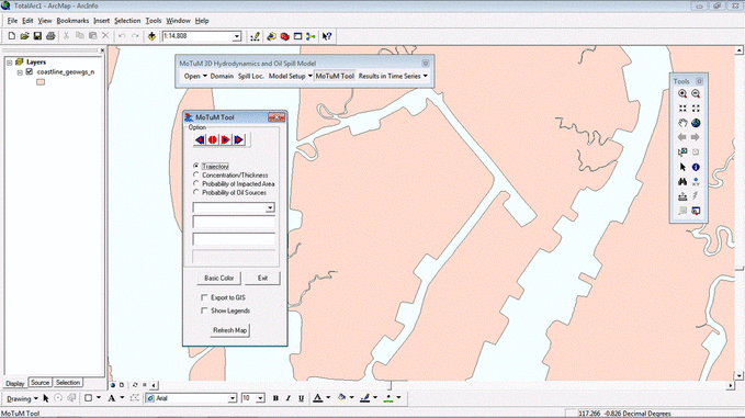
As Module in ArcGIS
ArcGIS User can run MoTuM and export to display the results in ArcGIS Software
Home
About
Product
MoTuM
MuSed3D
MuDrillCutting3D
MuHeat3D
MuQual3D
MuTsunami
MuFlood
MuDO3D
Clients
Marine Facility Design
MuTeknologi News
Blog
Lecture Notes